Sigh. Tough post. #Fedihired
So I found that #DOGE is currently in the org I work at. Ive confirmed from 2 colleagues. They're going after contractors first, since we have mostly no protections.
I've been looking since Nov 6, but now things are getting down to the wire.
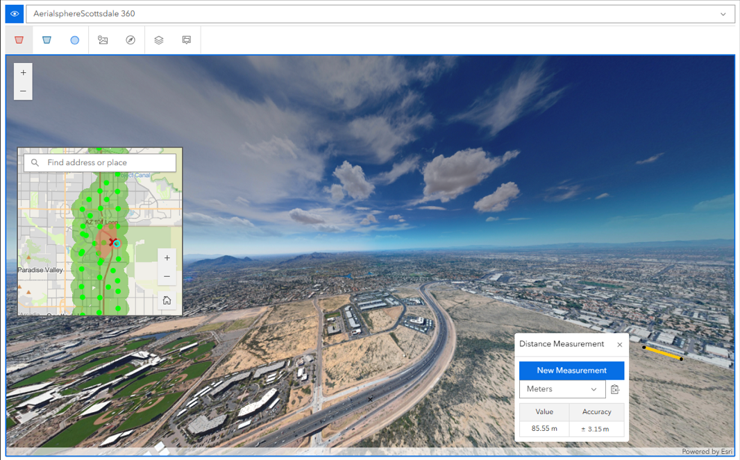
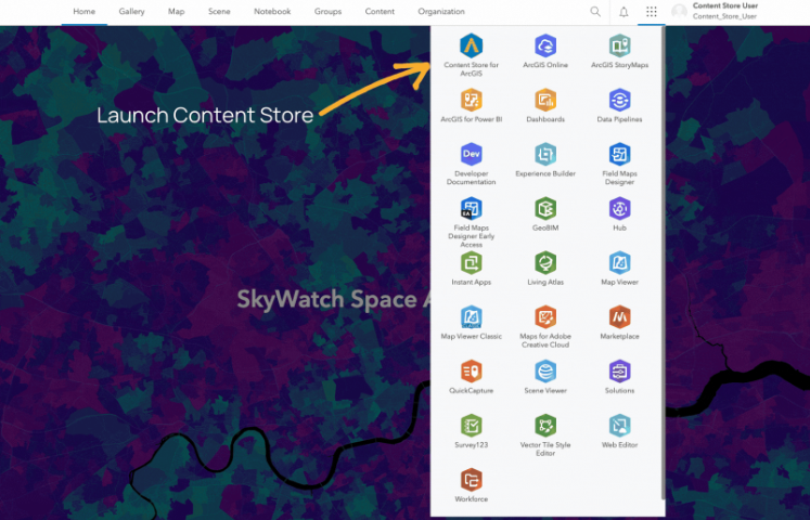
I'm a senior cloud systems engineer. Current is administering/developing #ArcGIS #GIS . Previously was systems engineer with greenfielding and putting together multiple ATO's. Before that, was systems engineer at a NOC.
I highly prefer #remote but can travel 60 miles around #bloomingtonIN


 Youhou ! Après le succès de notre extension pour QGIS, nous sommes fiers de vous révéler aujourd'hui la version pour ArqGIS Pro !
 Cette extension est le fruit d'un constat : on prêche depuis 15 ans des convaincu(e)s. Désormais, il s'agit d'aller à la pêche aux utilisateurices d'Esri, de leur faire découvrir les alternatives open source et de les convaincre de rejoindre la communauté des SIG libres.
 Lire le billet d'annonce :


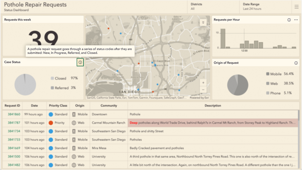


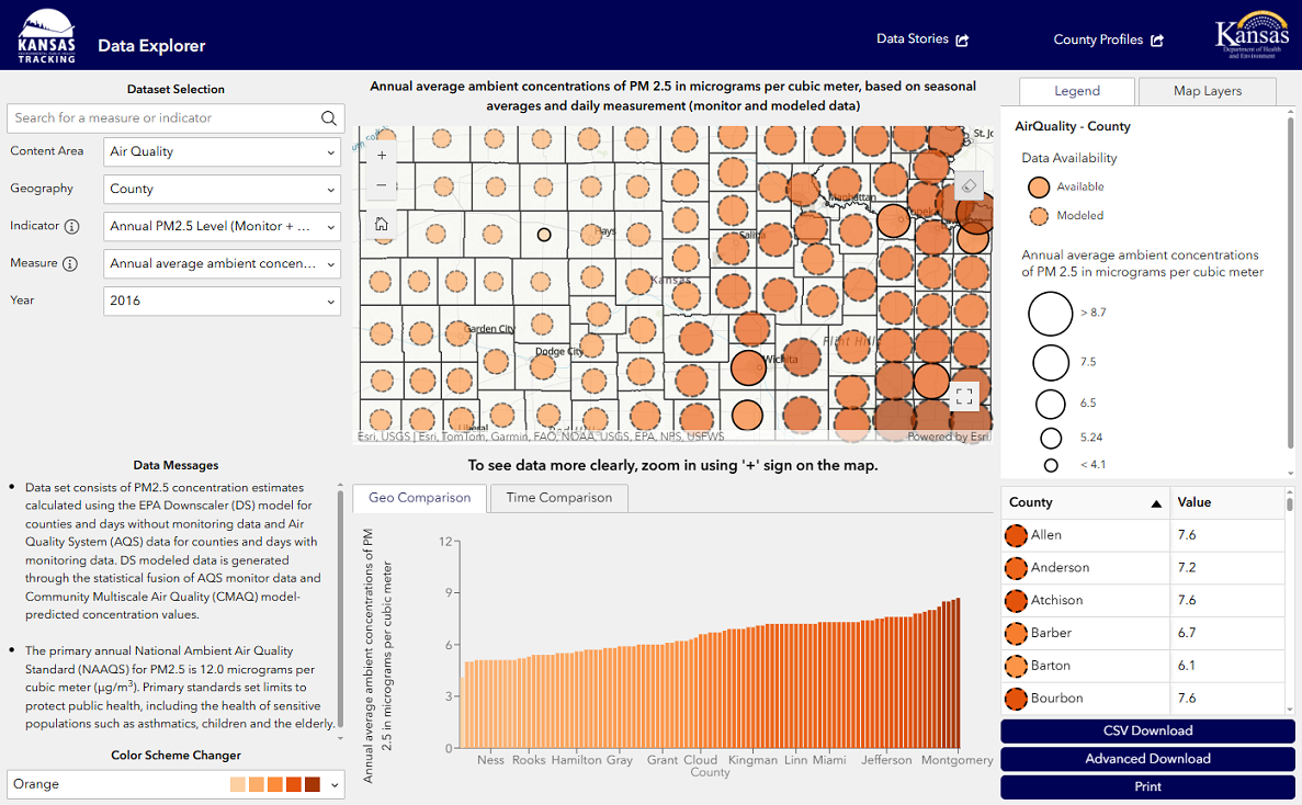
 Power BI – Excellent for visualizing trends like emissions and resource use.
 ArcGIS – excels at mapping hazards, monitoring vulnerable zones, and supporting emergency response.
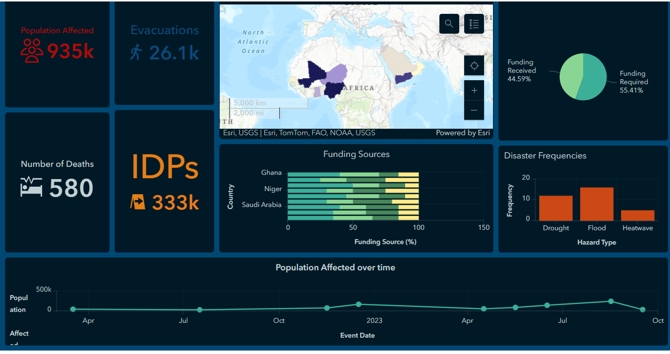


 Contexte: conflit intergalactique
  -
- 
 Mission: une contribution via une news pour la prochaine
  Rémunération: toute l'estime de la communauté géo
 Compétences: créer un ticket GitHub, manier du sabre géolaser
 Offre valable jusqu'au 21 février
 Postulez ici: