Replied in thread


@jon @spacehobo I have MyRouteApp from NL which is quite nifty and also comprehensive, might be worth a look.
#myrouteapp #navigation

@jon @spacehobo I have MyRouteApp from NL which is quite nifty and also comprehensive, might be worth a look.
#myrouteapp #navigation
Gibt es eigentlich auch ein Navigationsgerät für Autos auf opensource Basis?
Android Auto: Google arbeitet an Naivigationshinweisen per Smart-Glasses
Smart-Glasses für die Navigation statt Head-up-Display oder Infotainment-Display. In Googles Android Auto sind entsprechende Hinweise entdeckt worden.

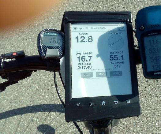
Ah yes, because what we truly need in 2023 is a #DIY guide to turn our beloved e-readers into high-contrast  #GPS devices. Why use an actual GPS when you can awkwardly fumble with your Kindle’s browser and a cascade of apps on your phone?
 It's like trying to navigate using a magnifying glass and a sundial.
https://www.instructables.com/Use-Your-Kindle-or-Other-Ebook-As-a-High-Visibilit/ #EReaders #EBooks #Technology #Humor #Navigation #HackerNews #ngated
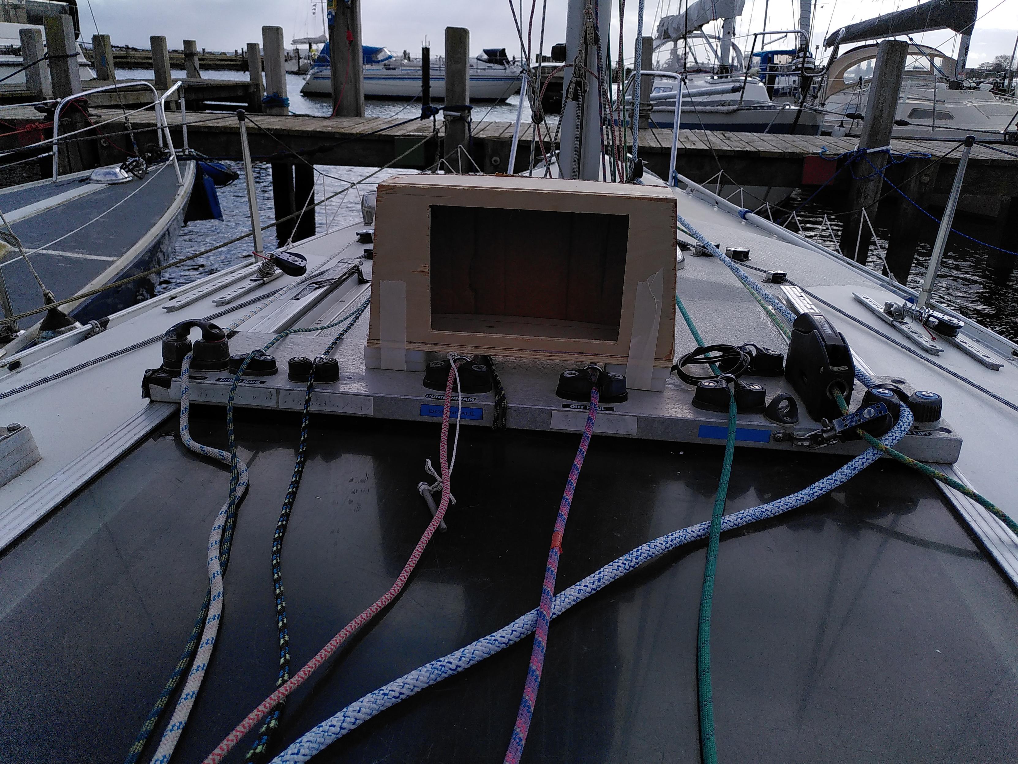
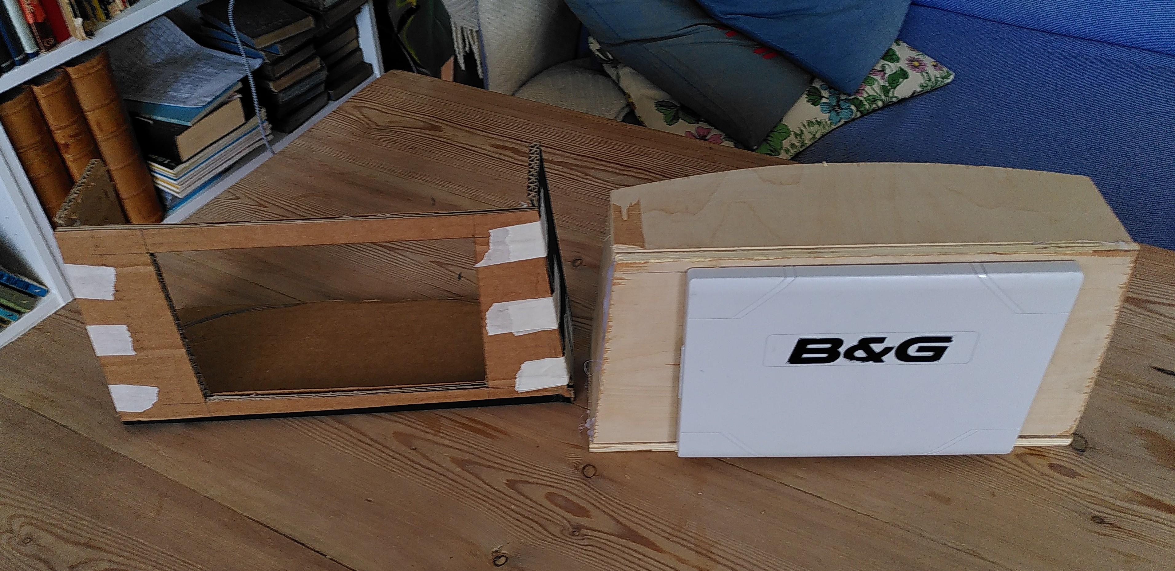
Model workshop today, working on housing for my b&g vulcan 7" plotter that I bought used last year. I place it on the roof top for best visibility, and the housing will protect it from saltwater spray ect, and all cabeling will be hidden and protected as well.
Next step is building the actial housing, and install the kit.
#google #maps #navigation #alternative #alphabet #herewego
I am testing alternatives to Google Maps (or Apple Maps) at the moment.
To be honest, the usability of the open source software available is rather horrible, so I heard from an old friend: Here WeGo. Old friend, because it was #nokia here long ago.
I downloaded the app for my #iphone and registered on the webpage for my browser.
The usability is very good! One time, the app hang up on me but overall this could become my daily driver
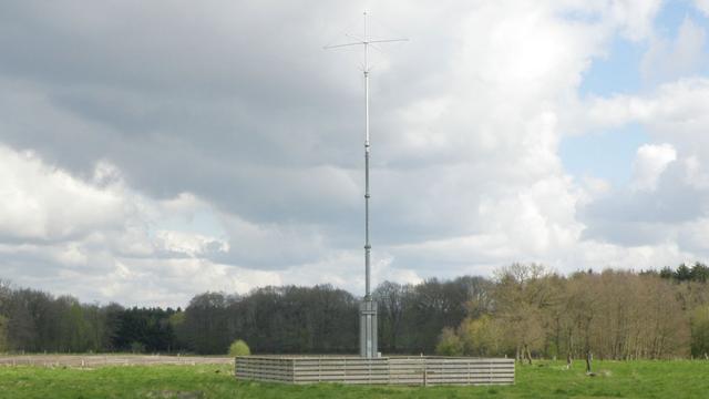
Ohne GPS: EU-Forscher entwickeln satellitenunabhängiges Navigationssystem
Mit Ranging Mode (R-Mode) treibt das Deutsche Zentrum für Luft- und Raumfahrt mit Partnern eine Alternative zu satellitengebunden Navigationssystemen voran.
New paper with Beate Zein
&
@jedalong :
 A new data-driven paradigm for the study of avian migratory navigation
We propose how the multi-modal multi-scale nature of navigation could be studied w/ data mining, machine learning & AI.
https://link.springer.com/article/10.1186/s40462-025-00543-8
It's the small things. Switching from bash to zsh I only just realized that I don't have to type 'cd' all the time... it's usually enough to just type the directory I want to enter, or '..' to go back... or ... if you want to be crazy... use "..." instead.
Apple/Bing/Google Maps Alternatives
It’s the Gulf of Mexico. It was named that before the United States even existed, and Donald Trump doesn’t have the authority to name it anything else, no matter what his decaying fascist brain may think.
Despite this, the big tech companies of Alphabet, Apple, and Microsoft, have all updated their maps to reflect what Trump wants. They can cave all they want. We have options.
Instead of using a mapping service which is beholden to the country it’s headquartered in, there is an open and worldwide service we can use, including for navigation. OpenStreetMap, founded in 2004, uses a combination of GPS traces, public domain information, and crowdsourcing. As the name indicates, the mapping information is open source and available to anybody who wishes to access it. This includes app developers who might wish to use OSM for mobile device navigation software.
There are two apps in particular, available on both iPhone and Android. The first is OsmAnd (OpenStreetMap Automated Navigation Directions), while the second is Organic Maps. Both apps are open source and are free to use. OsmAnd has a paid tier to unlock features such as unlimited maps (you only download the maps you need), while Organic Maps is funded by donations. Both apps work offline, so you can navigate even when you hit a dead cell signal zone. Most importantly, both apps focus on user privacy, as neither app collects any user data.
OsmAnd:
iOS download
Android download
Organic Maps:
iOS download
Android download

Organic Maps is a great Google Maps alternative that's free, open-source, and offline. I used it yesterday to find my way in an unknown neighbourhood, and it worked like a charm. 

#OrganicMaps #Navigation #GoogleMapsAlternative #Free #OpenSource #Offline #Privacy
From: blenderdumbass . org
Paps needs to walk from his room to a car, wait for you, the player to sit with him into said car, and then drive you across a town to a completely different location. Seamlessly.
Read or listen: https://blenderdumbass.org/articles/path_finding_in_upbge_for_dani_s_race

From: blenderdumbass . org
Paps needs to walk from his room to a car, wait for you, the player to sit with him into said car, and then drive you across a town to a completely different location. Seamlessly.
Read or listen: https://blenderdumbass.org/articles/path_finding_in_upbge_for_dani_s_race
So using a non-google maps app is possible & probably a good idea. Giving your location to google is not safe going forward.
Been using & experimenting with some & I think you might want to find some too.
Apps: https://european-alternatives.eu/category/navigation-apps
"Das Kartenmaterial erhält #Komoot von #OpenStreetMap. Wenn die Karte einen Fehler enthält, können unsere Nutzer diesen Fehler direkt auf OpenStreetMap korrigieren  ." * https://support.komoot.com/hc/de/articles/360022830972-Die-Komoot-Karte-mit-OpenStreetMap-verbessern
* direkt im Browser oder mit einer der o.g. apps, Anmeldung vorausgesetzt https://www.openstreetmap.org/user/new
Interesting the both OsmAnd+ and Google Maps were happy to guide me into this parking and hiking area. And both are throwing a hissy fit when trying to guide me out. No matter where too, nearby, north or south. Google want me to start my journey on the other side of the river. But OsmAnd+ wants me to somehow jump 70km, take a ferry, drive around Ibiza, take another ferry. Both apps and my Suunto watch gets GPS lock and shows me spot on, to where I am.
#Mapping #Navigation #OpenStreetMap #OsmAnd+ #NotLost #GoogleMaps
In Disney’s Moana films, the animated characters navigate using the stars, just like real Polynesian explorers. An astronomer explains how these methods work: https://theconversation.com/in-disneys-moana-the-characters-navigate-using-the-stars-just-like-real-polynesian-explorers-an-astronomer-explains-how-these-methods-work-245321 #astronomy #space #navigation #moana2
That's the kind of experiments I'd like to do:
"The experimenters moved around the maze during the procedure, feeding peanuts to other squirrels, to keep them away from the apparatus."

source:
Spatial orientation on a vertical maze in free-ranging fox squirrels
pdf: https://sci-hub.st/10.1037/0735-7036.113.2.116
#PokemonGo Was A Plot To Use Your Data To Fast Track An #AI-Slop Google #Maps Competitor
#Niantic is using scans of the real world from the game to create an AI-based #navigation system https://jalopnik.com/pokemon-go-was-a-plot-to-use-your-data-to-fast-track-an-1851706279